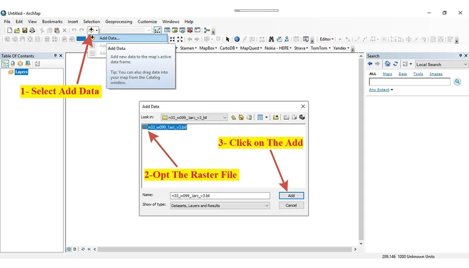
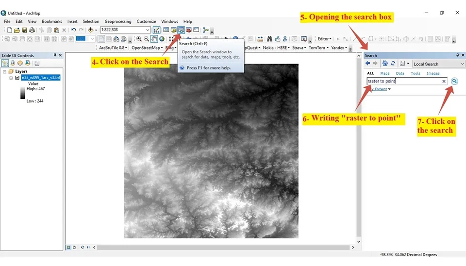
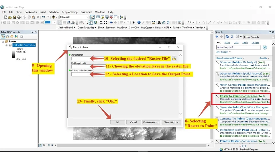
How to Convert DEM to Point Data in ArcGIS (Step-by-Step)
Unlock the full potential of your spatial analysis by mastering the precision of DEM to Point conversion in ArcGIS.
HHadi
· 30 min read· 12 views

In the past, designers and engineers used various software, such as AutoCAD, Microstation for designing, SAS, SPSS, and MATLAB for analysis and statistics. Besides, GPS was a tool for survey and analysis data survey. The development and growth of GIS caused most of this software to be mixed into ArcGIS.
ArcGIS is comprehensive software for the geographic Information System that was generated by Esri. ArcInfo is one of the first ArcGIS software programs created in the 1980s for analyzing data. ArcGis introduced a new version of this software, which is more comprehensive than ArcInfo, in 1999. Also, it is based on the programming language C++. This platform includes different components such as ArcCatalog, ArcMap, and ArcTools; one of these components is specifically tasked with managing and analyzing spatial data.
These days, technologies like mobile and cloud computing are adopting ArcGIS. Esri generated a mobile version of ArcGIS. Also, ArcGIS Online was introduced in 2015, which is a platform based on the web for managing and sharing GIS data. Also, they have developed ArcGIS Pro, which has the capabilities of 3D modeling and tools for analyzing big data and learning machines.
Accordingly, in the past, designers and engineers needed to refer to different software for designing and analyzing. Nonetheless, these days, ArcGIS is the most popular and used platform worldwide due to its extensive range of applications. This platform is used in various fields such as urban planning, natural resource management, disaster response, and similar items.
ArcGIS has several advantages, including tools for analyzing special analytics, generating maps with the highest quality, available global data such as satellite images, and also collaboration and sharing capabilities with other users mentioned. In addition, ArcGIS supports different formats of data, which has some facilities for strong management for organizing the data. Additionally, this software allows easy and fast work due to its user-friendly interface.


Comments
No comments yet
Be the first to comment
Share your thoughts and start the conversation.