
As sea levels rise, extreme events heighten, and storms become more severe, coastal communities globally face increasing threats
As sea levels rise, extreme events heighten, and storms become more severe, coastal communities globally face increasing threats, making the call for effective flood risk reduction more critical than ever. Floods represent a common and destructive type of natural disaster, resulting in significant economic and human casualties in various areas worldwide. Climate change has further disrupted the global hydrological cycle, leading to changes in the spatial and temporal distribution of precipitation and a rise in the frequency and intensity of water-related disasters, including floods on a global scale.
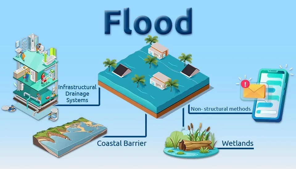
Coastal flooding is a rapid and unexpected overflow of a coastal area triggered by a temporary rise in water level resulting from a storm surge and extreme tidal conditions. Coastal flooding is a significant concern among the various kinds of floods, impacting more than 70 million individuals worldwide. Coastal flooding events have risen five times in the last hundred years as a result of higher sea levels, leading to an additional 14 million people residing in regions at a 1-in-20 annual flood risk (Lincke and Hinkel, 2021). Due to the extensive effects of the coastal flooding worldwide, which can bring both financial and human loss, the mitigation methods to diminish the impact of this natural disaster are required. Therefore, this article delves into the 4 different mitigation methods for coastal flood risk.
Table 1. Overview of different coastal flood mitigation methods.
Method | Advantage |
Coastal barrier | Offers robust physical |
Infrastructural drainage systems | Effectively minimizes urban flooding |
Wetlands | Enhances water quality |
Method | Disadvantage |
Coastal barrier | Elevated expenses for building and maintenance |
Infrastructural drainage systems | Needs consistent upkeep |
Wetlands | Requires ample space |
To download a detailed table of Different Coastal Flood Mitigation Methods click below:
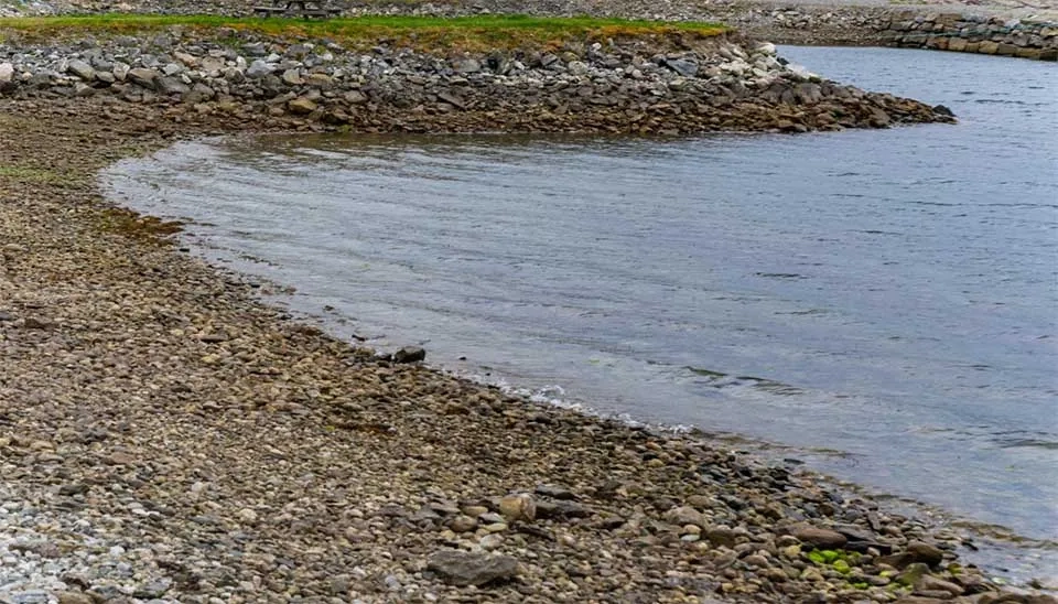
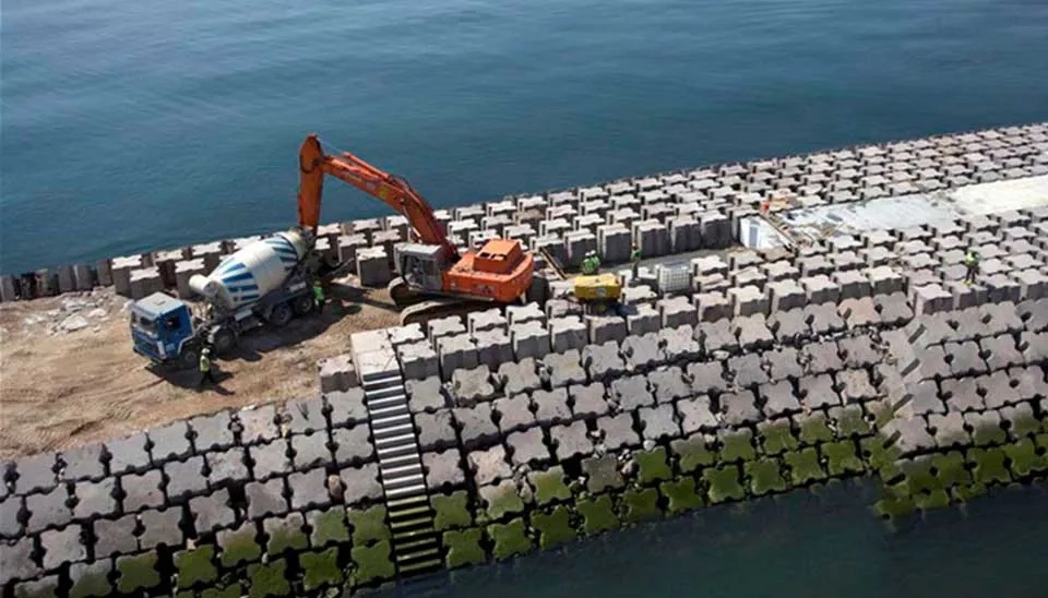
A prevalent approach to mitigate coastal flooding is the use of coastal barriers, which are landforms located at the land-sea boundary and compromise resilient engineering structures made from concrete or loose sediments (such as sand or gravel) (Ciampa et al. 2021). The morphological typology of the barrier's seafront is the most important part because of its capacity to redirect wave energy. Thus, a smooth surface configuration reflects wave energy, whereas a rough surface scatters the waves' direction and reflection. The latter may possess the ability to shift the sand away from or toward the mitigation structure, which is why nourishment actions should be implemented (Wong et al. 2014). In addition to defending against waves and rising sea levels, these barriers also safeguard the coast from wind and tidal forces. Furthermore, they can shield the mainland from storm impacts, including related landward water habitats that are safeguarded from direct waves and encircle a pond, marsh, or different water habitat. In recent years, coastal barriers have been designed and tested by blending various elements of nature-based solutions, such as utilizing barriers constructed from calcium carbonate rock sourced from coastal reefs, resting on a foundation of reef sand-block with a core comprised of concrete having a lowered pH (comparable to that of the ocean, pH 8.3) (Ferreira et al. 2016).
Regular coastal barriers are inflexible constructions and cannot adjust or react interactively to natural and human-triggered changes. As a result, they might not offer adequate coastal protection as time passes. The benefits of employing nature-based coastal barriers are found in their economical efficiency. These solutions safeguard and improve current natural coastal ecosystems that support habitats and species with significant cultural and commercial importance (Unguendoli et al. 2022). This preserves the appeal of local regions for visitors and the output level of the seafood market. Moreover, these solutions can capture inorganic pollutants while safeguarding endangered young fish and invertebrates, thereby promoting sustainable fisheries.
Coastal barriers are commonly utilized, such as in Portugal, where the coastline spans more than 987 km and features sandy landscapes experiencing significant erosion and flooding, highlighted by rates of coastal retreat. Climate change is acknowledged as the primary reason for floods in the coastal regions of Portugal. It includes rising sea levels, more frequent storms, stronger wind intensity, more powerful wave action, elevated ocean surface temperatures, and a changed chemical makeup of seawater (Santos et al. 2020). In Portugal, urban planning often includes coastal barriers to safeguard the coastal community from flooding and erosion.Costa da Caparica, a sandy coastal plain situated in the Tagus estuary, is among the Portuguese coastal cities highly vulnerable to erosion and flooding. Coastal barriers in Costa da Caparica have led to a 63% decrease in coastal retreat, a 32% reduction in erosion, and a 5% decrease in sea advance compared to the figures recorded before the solution was implemented (Ciampa et al. 2021). A coastal protection measure utilizing coastal barriers can preserve and shield approximately 10–15 m of shoreline from erosion, facilitating the recovery of 10,000–15,000 m2.
Solutions for infrastructural drainage systems focus on redirecting the waves that impact the shoreline. These solutions utilize integrated infrastructures to eliminate surplus water based on the average forfeiture load determined at the location. It can consist of one or more drains positioned parallel to the coastline, intended to improve seawater infiltration. The pipes are linked via blind pipes to a well, where the water is extracted and subsequently sent back to the sea or to an alternative location. The system causes a decline in the water table and, as a result, a rise in the thickness of the unsaturated zone. The relatively low water table boosts up-rush flux infiltration, facilitating sediment deposition along the coast and diminishing seaward sediment movement (Saponieri, 2019). Furthermore, this approach encourages the natural renewal of coastal sediments, aiding in the preservation of the equilibrium between erosion and deposition activities. The decrease in sediment flow to the ocean also helps create a more stable shoreline, which can lessen erosion risks and enhance the resilience of coastal structures. Through effective control of surplus water and encouraging sediment retention, the drainage systems improve coastal resilience to the effects of rising sea levels and severe weather events.
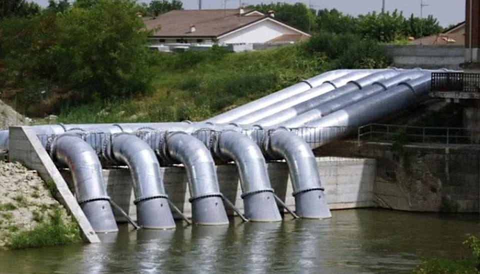
In Spain’s urban coastal regions, infrastructure drainage systems are extensively utilized, particularly where flooding affects tourism and leads to beach erosion, resulting in lasting impacts on coastal ecosystems. Barcelona has built walls to control stormwater in the city and prevent coastal flooding. Within the city, by the shoreline, 29 pumping facilities, 24 rain gauges, 197 water level detectors, 44 sluices, and 2900 supplementary sensors are managed automatically with connections through radio, 3G, broadband, and fiber optics. These pumping stations link to 15 water storage deposit systems, each able to contain approximately 70,000 m3 of water, and these deposit systems are tied to large pipes and pumping systems that can transport the water to the city’s sewage treatment facilities (Lozoya et al., 2013).
Constructed wetlands consist of a series of shallow, densely-planted artificial ponds that assist in filtering water via physical and biological methods. Constructed wetlands serve a delaying role, making them useful for aiding in flood mitigation along coastal flood paths. Since wetlands are typically regulated by a pit and a piped outlet, they can function similarly to a retarding basin by releasing flood flows at a managed rate. As more wetlands are built and rehabilitated on a large scale, the capacity for flood storage is enhanced, leading to a decrease in flood peaks. Created wetlands and wetland restoration have become widely utilized due to their capability to function as an efficient water treatment system and offer crucial flood risk management ( Acreman and Holden, 2010). Wetlands are gaining popularity as a nature-based approach for reducing flood risk because of their efficiency in managing floodwater, their capacity to span extensive regions, scalability, affordability, low maintenance requirements, and their potential to serve as a feature (Gato et al., 2022).
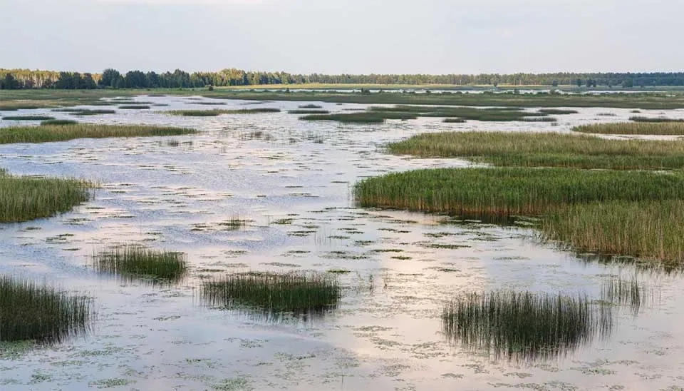
Aside from their advantages in flood mitigation, constructed wetlands offer several co-benefits, such as boosting biodiversity, enhancing water quality, and aiding in carbon sequestration. These systems form environments for a range of aquatic and terrestrial species, promoting ecosystem vitality and robustness (Mitsch and Gosselink, 2015). Wetlands additionally capture sediments and pollutants, enhancing the quality of water flowing into downstream systems or coastal regions, which is especially advantageous for communities dependent on clean water supplies. As climate change heightens the risks of coastal flooding, the importance of built wetlands in addressing these issues grows significantly. They enhance conventional engineering methods such as levees and seawalls, forming a hybrid system that integrates hard and soft strategies for flood risk management (Temmerman et al., 2013). Studies are currently being conducted to examine enhanced designs and setups for wetlands to optimize their flood reduction and ecological advantages across different climatic conditions (Morris et al., 2018). Future developments in monitoring and modeling technologies, like remote sensing and hydrodynamic simulations, can improve the design and efficiency of constructed wetlands, guaranteeing their effectiveness in reducing the effects of more severe and frequent coastal flooding events.
In northeastern Greece's Thessaloniki, a vast system of wetlands, canals, drainage channels, and embankments has been created to facilitate the absorption and storage of coastal floods. The wetlands hold back flood water, which is subsequently channeled through built canals into an underground drainage network where water flows from the coast to the inland area, and this water transportation lowers flooding levels by temporarily holding some of the flood volume in underground reservoirs typically constructed in nearby mountainous regions, at elevations up to 2400 m (Macklin et al., 2010).
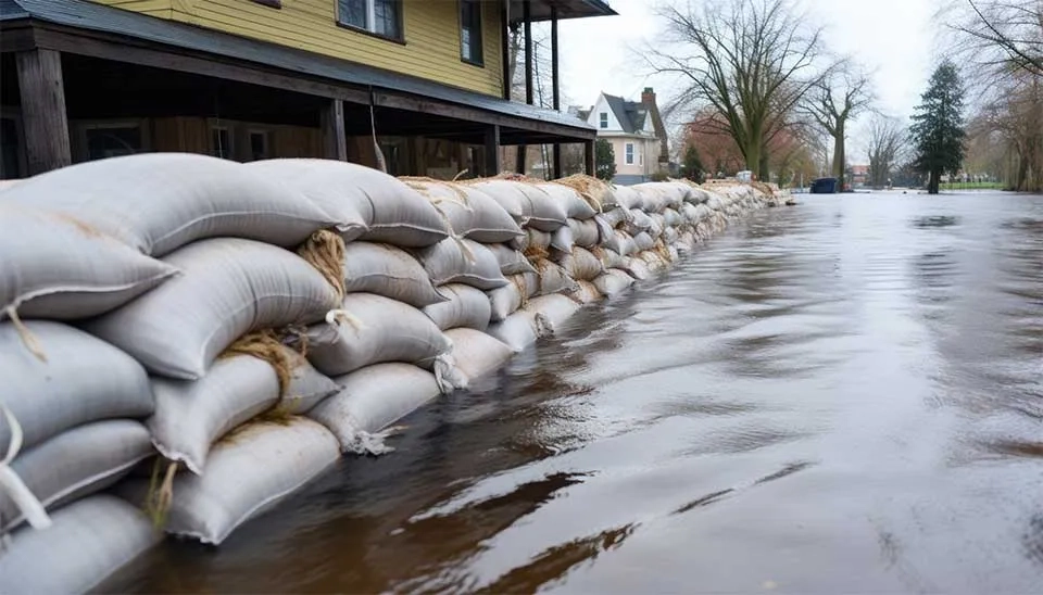
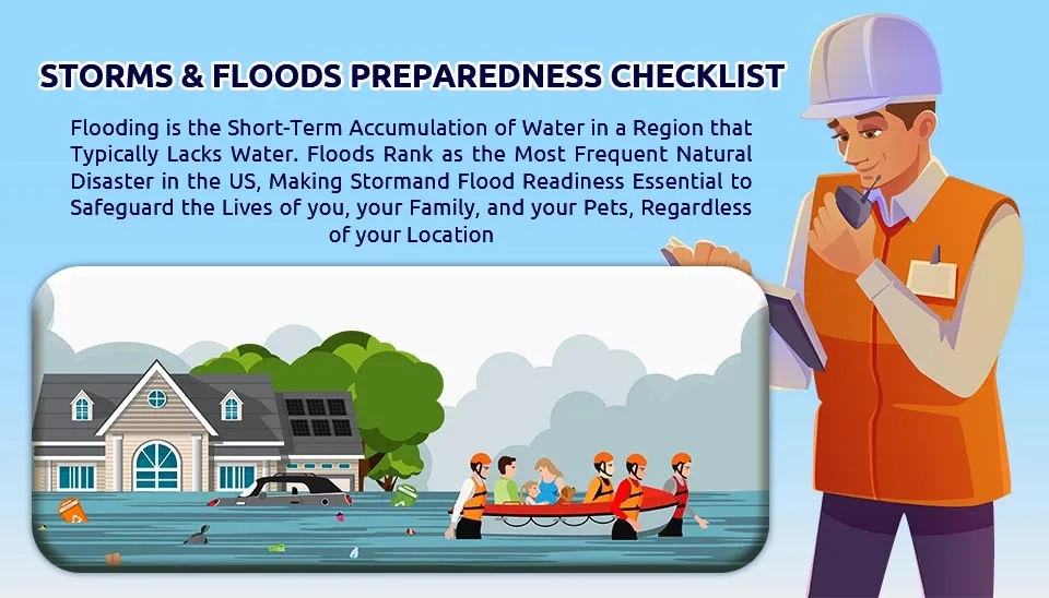
Non-structural flood management involves minimizing flood risk without changing the flood's natural behavior, proving to be both economical and efficient for flood risk reduction in the short and long term. Non structural methods include a variety of concepts , such as community preparedness, land-use planning, and flood early warning systems. Coastal regions are typically characterized by lower geographic elevations and are frequently linked to higher population densities compared to inland areas. Therefore, they must be exceptionally ready for floods. Readiness assists communities in determining and organizing the actions required during flooding. Effective management of evacuation during flooding heavily relies on community readiness and the individual. Understanding is a crucial element in disaster prevention and readiness and insufficient community awareness regarding the risks of disaster situations frequently results in a lack of readiness for flood prevention (Priyanti et al., 2019). Moreover, increasing community awareness via education, training, and public involvement is essential for promoting preparedness. Community response to flood events can be greatly enhanced through public awareness campaigns and disaster drills.
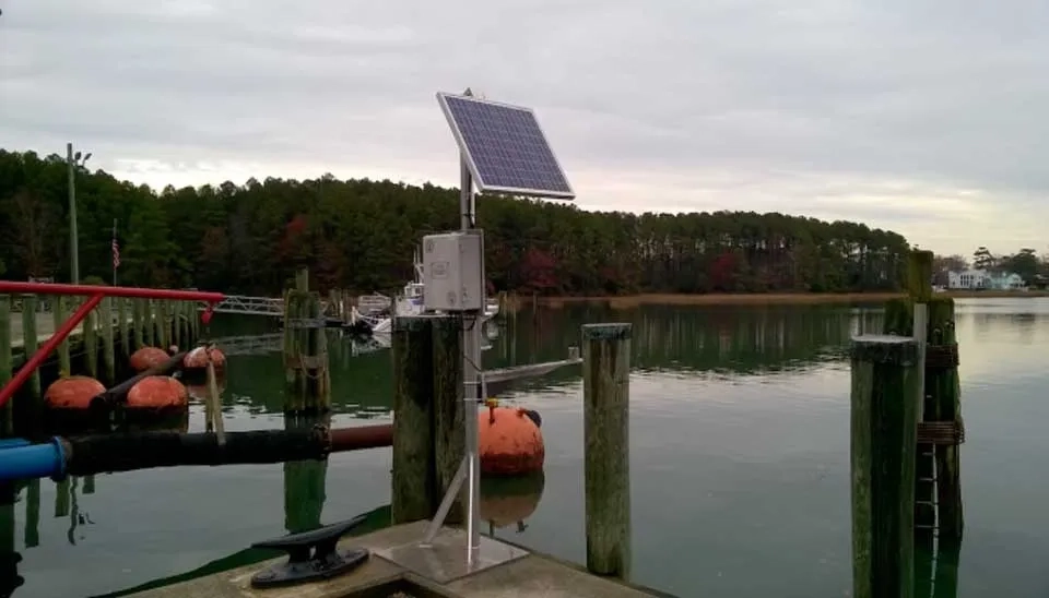
To manage coastal flood risks, flood early warning systems (FEWS) are essential and have been effectively deployed in various locations worldwide to mitigate loss and damage from flooding, particularly during severe events like storms and intense rainfall. Early warning is characterized by the International Strategy for Disaster Reduction as “the delivery of prompt and efficient information, via established organizations, enabling those at risk of hazards to take measures to mitigate or lessen their danger and be ready for a successful response.” FEWS goes beyond merely being a forecast. It consists of a unified system comprising four essential components: risk knowledge, monitoring and forecasting, warning dissemination, and preparedness and response capability. Warnings should convey essential information about upcoming dangers, be clear and understandable to encourage at-risk populations to take appropriate measures to prepare and respond to threats, and it is crucial to ensure that the at-risk individuals receive prompt warnings, providing them adequate time to undertake necessary actions for their safety (Cao et al. 2024).
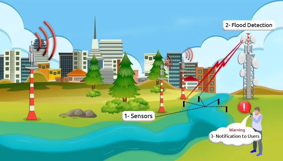
Developing a successful EWS for floods demands progress in several areas, such as the design, setup, and maintenance of sensor devices incorporated into flood protection systems, as well as a strong Information and Communication Technologies (ICT) framework for real-time data transmission, processing, and evaluation. Middleware technologies play a crucial role in effortlessly linking sensor data to pertinent documents, analytical tools, and modeling applications, facilitating the application of computational models for evaluating dike stability, forecasting potential failures, simulating flood behavior, and enhancing evacuation plans (Krzhizhanovskaya et al. 2011). Moreover, interactive visualization technologies are essential for conveying complex data, and the creation of a decision support system helps public authorities and citizens choose suitable flood protection measures and manage emergencies efficiently. To improve accessibility and responsiveness, these systems ought to include internet-based or specialized remote access options.

Many local regions and countries nowadays use FEWS to mitigate coastal flood risk. For example, The National Oceanic and Atmospheric Administration (NOAA) issues storm surge alerts for coastal regions in the United States. It combines weather and ocean data to forecast storm surges and their possible effects. Bangladesh’s Cyclone Preparedness Program is a strong community-oriented early warning system for coastal flooding resulting from cyclones. Community volunteers spread alerts utilizing megaphones, flags, and sirens, while forecasts rely on information from the Bangladesh Meteorological Department (Ahsan and Khatun 2020). In 2020, Cyclone Amphan prompted early warnings that resulted in the evacuation of 2.4 million individuals, reducing fatalities. The Japan Meteorological Agency (JMA) operates a sophisticated early warning system for coastal flooding resulting from tsunamis and typhoons by tracking earthquakes to forecast tsunami formation (Hoshiba and Ozaki 2014). Subsequently, urgent notifications will be transmitted via television, radio, and mobile devices. The Indian National Centre for Ocean Information Services (INCOIS) runs a system that predicts storm surges along the Indian coast utilizing real-time data from buoys and tide gauges, with alerts sent via SMS, apps, and local authorities. The Flood Forecasting Centre in the UK, a partnership between the Environment Agency and the Met Office, issues flood warnings for coastal areas THAT monitor tide and wave heights and have Flood risk maps refreshed in real time.
Due to the ongoing urban development in coastal areas, complex challenges arise for urban policymakers to implement effective risk mitigation strategies that ensure long-term coastal sustainability. Land use regulations can help mitigate flood risk in these regions. Land-based mitigation strategies, including managed retreat, property buyouts, and nature-based solutions, have gained popularity in addressing rising climate risks and ensuring long-term sustainability (Han et al. 2024). The managed retreat is a tactical method to avoid future harm from natural disasters by relocating individuals, property, and infrastructures from high-risk zones. The property buyout initiative, designed to utilize public funds for relocating high-risk properties in flood-prone areas, provides homeowners with fair market value for moving to safer locations (Greer et al., 2022). Land use zoning represents another form of land use planning that necessitates long-term organized planning and input from multiple disciplines, stakeholders, and decision-makers. In this context, land use planning suggests/controls the most suitable uses of land through regulations on developments in high flood zones and the reclassification of areas with low risks (Der Sarkissian et al. 2022). Nonetheless, this approach is constrained by current hazard maps, which frequently feature questionable risk thresholds concerning spatial areas.
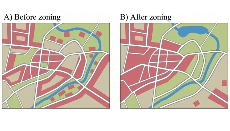
An instance of local zoning in the USA involves ordinances directed by the Federal Emergency Management Agency (FEMA), mandating compliance with floodplain management standards in regions designated as Special Flood Hazard Areas (SFHAs). These rules might encompass height standards for structures, limitations on building in hazardous areas, and the employment of flood-proof materials. States like Florida and North Carolina impose tougher rules controlling development in coastal high-hazard zones, mandating setback lines or banning certain construction types near eroding coastlines.
Coastal flooding presents serious issues for communities, ecosystems, and infrastructure, requiring the application of efficient mitigation approaches. This article has examined essential techniques, such as coastal barriers, drainage infrastructure, wetlands, and non-structural strategies, emphasizing their distinct functions in minimizing flood risks. Coastal barriers offer crucial defense against storm surges and erosion, while drainage systems improve urban resilience by efficiently handling excess water. Wetlands, both natural and artificial, act as important buffers, providing ecological advantages as well as flood control. Non-structural approaches like zoning laws, early alert systems, and public education initiatives enhance these measures by promoting proactive risk management and community readiness. Every approach possesses its advantages and drawbacks, yet their efficacy is enhanced when employed together, customized to the distinct features of the coastal area. With climate change intensifying flooding threats due to elevated sea levels and more frequent severe weather occurrences, a holistic, unified strategy is becoming more essential. Putting money into creative, sustainable solutions and involving communities in mitigation initiatives can greatly improve resilience. Coastal flood management should focus on safeguarding infrastructure while also conserving ecosystems and aiding vulnerable communities, providing a comprehensive approach to one of today's most urgent issues.
Quick answers to common questions.
Keep reading


Comments
No comments yet
Be the first to comment
Share your thoughts and start the conversation.